Tuesday, September 30, 2008

OFF TO THE WILDERNESS

Just a quick update - still here in Monson. My mail drop still hasn't arrived after a week (and Priority Mail sending) so I am assuming its lost and moving on. Luckily, there is a decent market in town - enough to do a resupply for the next eight days. Very frustrating since this is the fouth time a mail drop did not arrive, despite ample time and 2-day "priority" sending. (Atkins VA, Kent CT, Caratunk ME, Monson ME). Each time, it means wasted effort and money for both Elizabeth and me. At this point, I'd recommend to anyone planning a thru-hike to avoid using the Postal Service as much as possible! As soon as I buy food, my hiker friends and I will head out. We are still aiming for reaching the summit next Wednesday, but I will try and blog as soon as I finish. The weather looks good today and the rivers we must ford should be back down towards normal levels. Plus, we've given enough time for the large group of hikers who left yesterday to get well ahead of us. No sense in crowding in for the last section. Farewell, final town stop!

Monday, September 29, 2008

LAST DROP, LAST TOWN, LAST 100 MILES

Hi from Monson, Maine a tiny hamlet in the middle of the northern Maine forest, mile 2060-ish. This is the end! I got in yesterday with friends and found a full circus of hikers in town, all stacking up while the rainy remnants of a tropical storm move through. Us hardier types were happy to brave the weather for the last few days - the trail up here is insanely beautiful now that we've hiked into the peak foliage and no rain can disturb that. If anything, the leaves are even more intense without sunshine to compete with. At times, its like walking under a huge stained glass ceiling, with the light streaming down in yellow or orange. Plus, the rain makes for adventurous river crossings - we've forded big streams each of the last two days, with water above my knees both times. The good thing about fording is that once the shoes are wet from that experience, there's no problem walking through other puddles and mud pits anymore. When we arrived yesterday, there was no space left in either of the hostels here, and I was a little salty with some of the hikers who I know yellow-blazed up to Monson to avoid the rain. But, luckily, space was found at the Lakeshore House, which also houses the only bar in town - how convenient! You can image the scene last night was pretty raucous - two dozen or more hikers enjoying their final town stop before completing this long adventure. There's lots of friends here whom I haven't seen since Central Virginia, and even thruers I've never met before. Amazing to think I'm still meeting new people that started within a week of me back in Georgia. We are hoping everyone moves on early today now that the weather has broken. Unfortunately, Elizabeth's final mail drop hasn't arrived in time, and so I will have to decide whether I leave later today or early tomorrow. I did receive notes from other family members - thank you all so much. Monson is the start of the famous 100-Mile Wilderness, a stretch of Maine woodlands without any serious roads until Abol Bridge, near Mt. Katahdin. Once you enter, its very difficult to get out since there is no cell reception and the one or two logging roads in there carry no traffic. It means a huge carry of food, and the trail through this part is known for being boggy and host to waist-deep river crossings. It should be a grand way to approach Katahdin, which will loom over us towards the end. The forest should be spectacularly colorful throughout the wilderness, and its possible we may even get some snow at the higher elevations. Oh boy! At the end of the Wilderness is Abol Bridge, a tiny convenience store. Hopefully they have champagne there, because its only a brief hike from there into Baxter State Park to the base of Katahdin. Baxter is a neat place - a former governor of Maine bought the land and donated it for preservation as a wilderness park. This is the park's primary mission, and human needs are secondary to resource protection. There are only one or two campgrounds, and they are kept small and remote. Climbing Katahdin can be tricky - we climb more than 4000 feet to its 5200-foot summit, making it the largest single climb on the AT. Save the best for last! The peak is well above treeline, which is around 2500 feet here, and the summit can be blasted by winds. If Baxter's rangers feel its unsafe weather to climb, they will close the trails until the situation improves - all northbounders have had in the back of their heads October 15th, the date when the park closes its gates because historically the weather is too bad for climbing past then. I have attempted to climb Katahdin once before, in July of 2004, and was forced to turn around. I reached Pamola Peak, one of the three summits, and was about to head out onto the Knife Edge, a thin, rocky slice with thousands of feet of drop on either side, that connects Pamola with the true summit, Baxter Peak. A storm was supposed to arrive hours later in the day, but as I started out, the wind picked up suddenly, rain began to fall, and the temperature dropped into the low 40s. Being an inexperienced day-hiker, I only had a thin coat as protection, but I knew enough to get down as quickly as possible. Hopefully, Katahdin will accept my 2176 miles of penance and grant me a summit this time. If all goes well, the weather will hold and I will summit next Wednesday and Elizabeth will meet me when I come down the mountain. At that point, we will head to nearby Millinocket to rest and catch the others who summitted. From there I will try calling parents and such. Afterwards, Zen and Elizabeth and I plan to drive north, following the route of the International Appalachian Trail to its end at the tip of the Gaspe Peninsula in Quebec. This is where the Appalachians drop off into the Atlantic, a fitting end to a half year's walk. Obviously, the end is on everyone's mind these days, despite the partying going on in town last night. Most hikers are feeling ready to be done, especially with the recent wet weather. Myself, I'm ready to do something different too - six months is a long time to spend walking around the mountains. I don't think I would want to do this or any other long-distance thru-hike again. (Elizabeth says I'm not allowed to anyway.) At the same time, it is such a beautiful life out here and I'm not ready to leave the simplicity and freedom that exists on the trail. Re-entry into the normal world is going to be tough. I talked to a friend named Banjo, who summitted last week. She says it was very scary coming down from Katahdin, no longer a thru-hiker. Friends she knew deeply for months were suddenly whisked away by relatives, and within 24 hours, she was back in her home, overwhelmed by the stimulation and not sure what to do without a white blaze pointing the way. I can already feel the emotions welling up, and expect to be a blubbery mess on that final day. The road trip to Gaspe is intended to ease the transition, and I plan to take a few weeks at home to work on some overdue house projects as a way to move on from the trail. But there will be plenty of time to post about how the aftermath goes. For now, there is still 115 miles left that require my attention. Into the Wilderness and beyond!

Thursday, September 25, 2008

CARATUNK IS (SLIGHTLY) MORE THAN A POST OFFICE

Greetings from Caratunk, Maine. I am staying at a deep-Maine resort that is between seasons and is offering hikers rooms for $10 a piece - the cheapest on the trail! Plus they brew their own beer and have a hot tub. This is the second-to-last town stop - only Monson lies between me and Katahdin. I crossed the 2000 mile mark two days ago, and at this point only 150 miles of Maine and the Trail remain. The Bigelows were an amazing range to end with, and we spent a very cold night at a campground in a small col between the two tall peaks to celebrate our last true mountain range. Since then, we've dropped lower and have passed by four huge lakes. Camped at one, which had a large sand beach - so I can now claim I did get to lie on the beach this summer; it just took me until late September. The days are getting shorter - even on the relatively low and easy terrain, its hard to make more than 13-14 miles each day. Plus, there is the timing of the ferry service across the Kennebec River. I hit the ferry this morning, which consists of a guy with a canoe. You'd have to be joking if you thought I might try to cross the river. I spent the summer hiking, not swimming. The river is as wide as the Schuylkill, six or seven feet at its deepest, but flowing faster than someone can walk. The ferryman told me only eight people attempted to ford the river so far this year - half came back and took the canoe, and the other half regretted it. Maine continues to amaze, though now that I'm back down below 2000 feet, its like I've stepped back three weeks or so in time. The trees are mostly green and its much warmer at night. There hasn't been rain for more than a week, but the ground still has plenty of water and is still muddy, though it tends toward tacky rather than soupy. We hiked part of the path taken by Benedict Arnold and 1200 other soldiers who in 1775 marched through Maine to invade Canada, hoping the French Canadians would rise up against the British too. Instead, they bogged down in the mud of Maine and showed up with half the men to Quebec City, a fortress atop cliffs with an uncaring population. Didn't work out so well. We have a few big hills and some more flatland before Monson and the 100-mile Wilderness. The end is near. A week or so ago, other hikers and I were ready and willing to talk about the end: what we'd miss (sunsets, the solitude of a tent); what we can't wait to get back to (eating fresh fruit and veggies, running water); and what would cause us trail de ja vu (tuna packets, hanging out with more than one bearded guy at a time). Now, the end is too close to talk about. Instead, we are having more and more quiet moments staring at the campfire, spending more time looking at the stars, and hiking in silence to better hear the forest. Trying to enjoy what we have taken for granted for so long.

Sunday, September 21, 2008
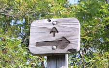
STRATTON, MAINE

Stopped into Stratton, Maine for a night while Zen and I wait for Monday so we can retrieve packages from the post office. The town has cheap lodgings and is a nice place to rest from a tough week of hiking. We went over beautiful Saddleback Mountain in a strong wind, well above treeline, making for a cold cold experience. The thought around camp that night is that at 100 miles further north, 2 weeks further in the year, and 1000ft higher, Katahdin is almost guaranteed to be freezing cold when we summit. We did spent the next night on Maine's second highest peak, Sugarloaf, which was also windy and cold at the top - but we stayed in the ski resort's open summit house with its wood-burning stove. From the summit, Katahdin is clearly visible, though still far away. We could also see that the next range of mountains, the Bigelows, will be our last large range. After that, the trail drops and stays fairly low, with an occasional lone peak to climb over. Between this town and my next stop in Caratunk, we must ford several rivers. One of these is the largest un-bridged river crossing on the AT, the Kennebec River. A canoe ride is offered to hikers crossing this river, as unpredictable dam releases upstream make is a very dangerous ford - a hiker died while crossing it in the 80s. Some hikers still attempt to ford it, with swift currents and water up to the chest. The weather has given us picture perfect blue skies for the last few days, and the forecast shows it continuing into this week. In good weather, Maine is a real treat. The birches are bright yellow, and the lower maple forests are changing more rapidly now that there's been a few frosty nights. Should be a good show by the time we get to the 100-mile wilderness. My body has recovered from the beating it took in the Whites and southern Maine. Feels nice to not hurt every time I stand up!

Wednesday, September 17, 2008

RANGELEY, ME

Hi all from Rangely, an attractive small town here in the wilds of Maine, where I'm stopping in for resupply. Its only the third day since resupply in Andover, but that town only offered snack food. One of the joys of thru-hiking is eating like a ten year-old, but two days of sugar is enough. We had a few days of rain as the remnants of Ike came by, but yesterday and today have seen gorgeous weather and the rest of the week looks beautiful. This state is tough when the weather is bad, but when the sun is out and the views are open, Maine is quite a place. We've been hiking past many lakes recently and its nice to see them left undeveloped with only a cabin or two on each. This area of the state is close enough to attract the crowds from southern New England, so its nice to know not everything is being built upon. I don't think we will spend the night, despite the strong temptation of karoake at the local watering hole. The weather is too nice to stay around town, and we're trying to take advantage of the woods while they last. Supposedly, on really clear days, the next mountain we go across - Saddleback - has views of Katahdin. So, literally, the end will be in sight. Lots of mud with the recent rain, though nothing like we experienced in Vermont. And the Maine ATC, which maintains the trail in the state, definitely likes their reputation as a wilderness. The few log crossings over wet areas are often broken and rock and root hopping is the norm. We've been lucky in that the rivers we've had to ford so far are all low, allowing us to hop rocks across. But soon, we will have to ford some more serious rivers, so I will have wet boot days to look forward to. My gear is starting to fall apart with the wear from 5 1/2 months. I've had to replace a second rod in my pack, my water filter, a broken pole tip, and repair some torn clothing in the last few weeks. I thought my second pair of shoes would make it, but they've become a liability with the wet walking, so I've asked Elizabeth to send up my old heavy boots. Hopefully, everything else will manage the next few weeks. The Maine forest has been a delight. The leaves are still slowly changing, but the forecast calls for a few nights of below-freezing lows, which should snap them into color. Really looking forward to that. Moose tracks and scat are everywhere now they are in rutting season, and we heard some coyotes barking at each other last night. No signs of bear yet, but they may be down in the lower areas, filling up on berries right now. Hope all is well, I'll write again from Stratton in a few days...

Sunday, September 14, 2008

MAINE AT LAST

Maine. For many months, its been a far-off destination - the answer to the question "where are you hiking to?" that other dayhikers and tourists always ask. And now I'm here at last, and have to answer the question differently, with "Katahdin". I crossed the NH/ME border a few days ago, passing a small sign posted to a tree in the middle of nowhere: Welcome to Maine, the Way Life Should Be. And by that, they must mean life should be exhausting. The transition into Maine from the Whites isn't "seamless" as someone suggested - in fact, it becomes harder. The mountains may not be as grandiose as the Whites, but they are more rugged and the trails are rougher and more unkempt. And as we get further north, the treeline drops and the temps become colder. No more camping on mountain tops! Two days ago, we went through Mahoosic Notch, often billed as the "toughest mile on the AT." For a full mile, the trail goes along the bottom of a big canyon, with steep cliffs on either side, and the bottom is filled with boulders ranging in size from tires to full tractor trailers. There's no real "trail" there, its more of a scramble over, around, and even under the boulders. Lots of scrambling up tilted rocks, jumping from rock edge to rock edge, climbing with hands instead of poles, sliding down rock faces, and even squeezing through holes under large slabs. Last year, a moose died in the notch, having broken his leg in a fall. Supposedly someone shot him before he slowly starved to death. My path took me next to his skeleton right at the beginning, which made for a "oh, what am I getting into?" moment. But I made it through, which is more than the moose can say. It took just about 3 hours to do the mile - a little slower than a more typical average of 2 miles per hour. Obviously its quite a challenge to do the notch with 40+ pounds on your back, but thru-hikers up the anty by challenging each other to NOT remove their packs at any point. Proud to say I kept mine on the whole time, despite having to go backwards through one really tight squeeze. Its only been a few days, but "wild" is exactly how I would describe Maine. The views from the peaks look out on a vast forest, disturbed only by logging roads. Its a rare treat to have such an amount of undeveloped land in the eastern US. Someone once described Alaska as Maine on steroids, but I would describe Maine as more like Alaska's grandfather. Old granite mountains only recently uncovered by ice, mature forests with huge birches and spruces, moss covering everything, and moose scat is everywhere (though I haven't seen one since NH). I am staying at a hostel tonight in Andover (mile 1,930ish), which has maybe nine other buildings - an old logging town with a definite frontier feel. The hostel is a great old wooden building with lots of different rooms upstairs, and when I asked the owner if it was always a hotel, he says he's looked at old pictures and there's always a few ladies in dresses hanging out on the upstairs porch. So yes, always a hotel of sorts. It rained most of the day today, which made for a muddy trail, and I earned a nice bruise on the knee after taking a spill. Nothing serious, but took a nice photo of blood running down my leg with the rainwater. The body is definitely feeling tired - the Whites and Maine are like a totally different trail than the rest of the AT. But nothing will stop me or any other hiker now with less than 300 miles (and perhaps only 3 weeks) left. Still a large stretch of tough going to get through, and then the famous 100-mile Wilderness at the end, but I'm coming for you Katahdin!

Tuesday, September 09, 2008

I'm tired just looking at the map...

Let's go back to the beginning, when we started with our ten feet of crazy map that gave its name to this blog. For some more perspective on just how far Shawn has come, take a look at this... and then read on to see what he's been up to lately!! His estimated end date (as of this morning, pre-rainy-day off in Gorham) is October 4th.

GOIN NOWHERE IN GORHAM

So, here we sit in Gorham. It is raining all day today and over breakfast Zen, Thinker and I made the executive decision to spend another night here in town. Later tonight and tomorrow will be clearing and we'll push hard this week to make up the miles. Rest is needed too. The rocky and steep trails of the Whites have beaten my body up. I've had no knee problems this whole trip until the Whites and my feet are meaty stumps at this point. It won't stop me, but it is kinda fun to watch them swell up overnight. The next bit of trail looks difficult too - someone asked a southbounder how the transition into Maine will go, and she replied "seamless."

It does feel great to be entering the final state of the AT. Autumn has already started in the boreal forest of the higher elevations - birches are turning yellow and dropping their leaves across the trail. Down the mountains a bit, in the mixed hardwood forest and some of the early maples are already turning red-orange. Of course way down in valleys like the one Gorham sits in, its still summery green. But the cold nights are giving us the signal that autumn is arriving even here, and pretty soon we'll be pushed out of the woods whether we are done the hike or not. Baxter State Park closes its trails to hikers on October 15th, but we should be done by the first week in October.

So, some chores and errands, but a mostly lazy day of sitting around and watching television. Its hiker Saturday!

Monday, September 08, 2008

THE WHITES ARE OVER

Hello from Gorham, NH, mile 1880ish - under 300 miles are left. Most of these will be in Maine which I will enter in 2 or 3 days. For now, rest. Traversing the Whites was the toughest part of the AT and easily some of the toughest hiking I've ever done. The trails are steep and often require climbing sharply sloped rock faces, which can be slow-going - especially in rain. There are few flat areas, and climany ascents and descents along the ridges. Five major gaps, called notches here, mean huge drops and climbs of several thousand feet in short distances. We tended to average 1.5 miles per hour, about 10 miles per day. Here is a little more detail about the past week:

The weather started out iffy as we went over Moosilauke and the Kinsmans, which may be the toughest climb on the trail. We spent a night doing work-for-stay at the Lonesome Lake Hut and slept in their dining room. Then we spent a half-day and night resting in Lincoln, NH at a house whose owner invites hikers to stay. Chet is a former hiker who suffered massive burns in a cookstove accident and after a recovery that took years of surgeries and drugs (and millions of dollars), he now hosts hikers at his home. Very cool guy. My cousin Robert paid a visit and acted as trail angel for us thruers - thank you for the fun time and we'll get together for a hike at some point.

The weather cleared and was beautiful as we climbed Franconia Ridge, which peaks at the 5,200 ft Lafayette. The sun was great for warmth, but the wind was gusting up to 50mph along the exposed ridge. This was our first distance run above treeline and the views were outstanding. Lots of dayhikers were out on this Labor Day, and as tourist attractions, we got to answer many questions about our trips. The trail turns right onto Garfield Ridge, and after watering up, we spent the night on the lee side of Mt. Garfield's summit. Cowboy camped and watched the sunset and then the sunrise with an amazing array of stars between them.

The next two days continued the good weather and at the end of the second day we climbed onto the exposed Presidential Ridge. This is an alpine zone that is essentially tundra - you'd have to go a thousand miles north to find similar environments. We camped on Mt. Eisenhower, enjoying the sunset and the purple glow of Mt Washington, just 2 miles ahead of us. At this point the clear weather ended and clouds came in and dropped overnight, first covering Washington and the highest peaks and then lowering to our peak next. When we woke in the morning, we were in a dense fog and the wind had picked up to 25-30mph. No one wanted to leave their bags but they were getting soaked, as we had cowboyed sans tent here too. So, up and march through the clouds with 50ft visibility, looking for the manmade rockpiles called cairns ahead, since there are no trees to blaze and the path on bare rocks is easy to lose. Warmed at Lakes of the Clouds Hut and lunched at the cafeteria atop Mt Washington after the last grueling climb. On the way along the next ridge, the trail crosses the cog railway which takes tourists to the top. As per tradition, the shorts came down, and the full moon came early for some of the passengers.

The rest of the Presidential Range is exposed as well, making for over 12 miles above treeline that we covered that day. We spent the night at a very very crowded Madison Springs Hut and the next morning we decended back into the trees on a very windy and exposed ridgline that was above the clouds. Rested at M&M's house and then tackled another 3 days of big peaks, rain, and cold evenings.

Friday, September 05, 2008

TRAIL MAGIC IS THE GIFT THAT KEEPS ON GIVING

Hi everyone - The Thinker, Zen, and I are resting here in North Conway, New Hampshire at the vacation home of a former thru-hiker named M&M. I met M&M and her boyfriend Pootz in Georgia on March 31, my very first day, while going up the approach trail to Springer Mountain. They had thru-hiked the AT last year (in fact they met on the trail) and were back to do the approach trail and provide some trail magic. I spent most of the hike talking to them, asking them questions, and was the first to benefit from their trail magic - two beers to end my first day with! M&M had mentioned a place I could stay once I got to the Whites, but of course I had forgotten all about it until she emailed me last week. So, here we are enjoying delicious home-cooked beef stew, beers, and ice cream and watching movies. Trail magic is a fabulous gift and I can't wait to pass on my good fortune to next year's hikers.

So this afternoon is a perfect time-off from hiking the Whites. The Whites are tough. Easily the most challenging terrain of the AT thus far, possibly of the entire trail. But the most rewarding too. We just spent 5 days going over Franconia Ridge and the Presidential Range, doing about 10-13 miles per day - the lowest mileage since the beginning. We were fortunate to have some incredible weather for most of those five days - the weather was so benign that we actually spent nights on Garfield and Eisenhower peaks, above treeline. I should warn any kids out there that it is not only technically illegal to camp above treeline, but its very dangerous given the changeable weather the Whites are famous for. Best to leave it to the professionals like us. I can't describe the incredible sunset and sunrise from Garfield but I can say that we received some comeuppance while on Eisenhower - the night started warm and clear with a fantastic view of Mount Washington, but we woke up deep in a cloud with 30mph winds. The mountains were clearly angry about our presence at night, because the bad weather continued all day, socking us in for our climb up Mount Washington (which is really rather typical - its cloudy there 80% of the time.) The weather broke this last night and this morning's climb over Madison had some stunning views once again.

The AMC, which runs the huts and campsites and maintains the trails in the Whites, does an excellent job with everything. Its amazing the Whites aren't a national park, given their beauty and history and natural importance. But the non-profit AMC and the Forest Service run the area as effectively as the National Park Service, and so it provides an interesting alternative in the world of recreation management. My only complaint is that the Appalachian Trail, admitedly a newcomer to the AMC and other entities in the Whites, is clearly of secondary importance. The trail is barely blazed and uses existing trails (and keeps their names), and there are few free campsites or shelters for thruhikers, who are unused to paying for nights in the woods. A few more facilities for us would've been helpful. We've stayed at two AMC huts - Lonesome Lake and Madison Springs - doing work-for-stay at both, which requires minor duties in return for sleeping on the floor. Both huts were very relaxed, albeit crowded, places. The "croos" who operate the huts and carry up supplies via trails are amazing to watch - they really are great teams and reminded me of the crews I've seen work on tall ships.

So, we will enjoy a rest here today and get back on-trail tomorrow morning to complete the Whites. Just a few more days left in New Hampshire and then the wilderness of Maine!

How much is left?

We have a map on the wall here at the office that I've been marking each time I talk to Shawn, or get an update on his location. From the picture here you can see the green thumbtack I marked on Monday, after I talked to Shawn over the weekend- they are almost through the White Mountains, and you can see very clearly how little of the trail he has left. Its only about 300 miles from where he is now, to the end.

Today's update: They are near Pinkham's Notch (a bit north of the green thumbtack), and got to spend two of the last 5 nights on top of mountains! A trail friend he met at the very beginning of his journey has offered he and his buddies a place to stay (and shower) tonight, and then its maybe 2 more days or less into Gorham, NH. And, he’s still right on schedule!!

Wednesday, September 03, 2008

Trail Update

Hello from Philadelphia - From what I hear, things are going well on the trail. The weather has improved, and with it, so are spirits. Shawn is somewhere between Lincoln and Gorham, NH, which leaves him with only about 4 weeks left. I spoke with him this weekend; he had the opportunity to have dinner with his cousin Rob on Saturday night, and they had a great time.

A BIG thanks to everyone for the continued letters and treats … as Shawn has been receiving them, he mails them home to me for safe keeping (the letters, not the treats unfortunately), and its been wonderful to read all the words of encouragement he's been receiving. So thanks, from the trail manager, for your help in keeping him on track!

These days Keychain is very close to his original schedule... putting him at the end of the trail on Mt. Katahdin on or near the 4th of October. So, if you're thinking of sending a last package or card to his mail drop in Monson, Maine, I'd make sure it was there by the 21st or so of September.